Welcome to geoMinds
Who we are . .
We are a young and innovative company, always looking for smart and creative solutions to support you with your geographic and geospatial related projects.
Get to know us
What we do . .
We offer comprehensive GIS and remote-sensing referred services as well as innovative software solutions to optimize and enhance your project work.
Find out more
hydroMinds-Tool
hydroMinds is a computer-based analysis- and decision-support tool for siting economically viable hydropower opportunities. The online tool allows the user to modify all relevant input parameters to prove and analyse sensitivities at located sites.
Find out more
gvSIG Starter-Package
To support the introduction of the open-source GIS-software "gvSIG" at the Welthungerhilfe, we developed an interactive CD-ROM providing all essencial information to implement gvSIG in development cooperational project work.
Find out more
Download Center
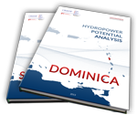
On behalf of CREDP-GIZ, geoMinds applied the hydroMinds-Tool to analyze the hydropower potential of the eastern caribbean states of Dominica and Saint Lucia.
The referring reports and more can be found in the download center.
Download Center
The referring reports and more can be found in the download center.


