


Government of Saint Lucia
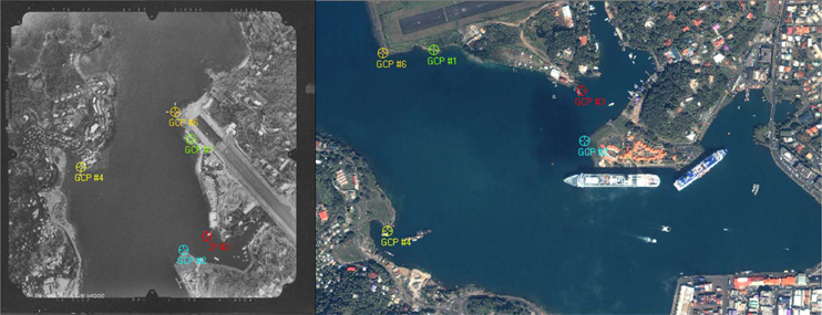
In 2009, the Survey and Mapping Department of the Ministry of Physical Planning and the Environment, St. Lucia was advised in digitizing, organizing and storing a series of aerial photos of the island. This included the orthorectification of the digitized images as well as staff training in using geospatial software products for geo-data management and basic GIS-analysis to conclude the orthorectification process with historic datasets. For visualizing, managing, creating and analyzing geographic data, staff was trained in using ArcGIS as well as Erdas Imagine, a geospatial raster data processing software to prepare, display and enhance digital images for mapping use in Geographic Information Systems and Computer Aided Design (CAD) software.
EXTERNAL LINKS
› Government of St. Lucia
RECENT PROJECTS
› WRMA St. Lucia
› CREDP-GIZ
› Deutsche Welthungerhilfe e.V.